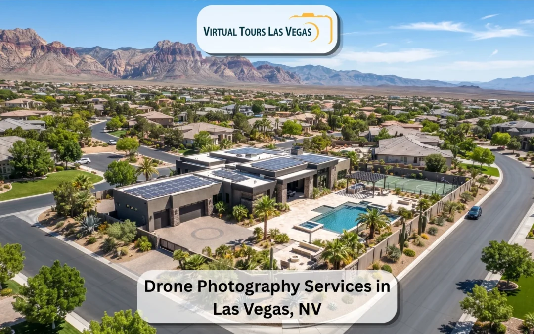
A property's location is often its strongest selling point, and a ground-level camera cannot show it. Stand on the sidewalk outside a Las Vegas high-rise and you see a wall of glass; rise two hundred feet and you see the Strip a few blocks east, the freeway on-ramp around the corner, and the retail district at the building's feet. That context is exactly what an out-of-area buyer or developer needs, and it is exactly what drone photography delivers. Aerial imagery places a home or commercial space inside its real surroundings, telling a location story no interior shot can.
This guide explains what real estate drone photography involves, what aerials reveal that ground photos miss, the licensing and airspace rules that matter in Las Vegas specifically, and how to decide whether your listing actually needs to fly.
What is real estate drone photography?
Real estate drone photography uses an unmanned aircraft to capture a property and its surroundings from the air. Instead of the eye-level view buyers get from standard listing photos, aerials provide elevated angles that reveal the full footprint of a parcel, the layout of the lot, and how the property connects to its neighborhood. The category covers both still aerial photography and aerial video, and it is sometimes called drone or UAV photography.
The value is perspective. From altitude, a camera frames the relationship between a building and everything around it: roads, amenities, landmarks, open space, and boundaries. For listings where location, land, or scale is the main draw, that elevated vantage often carries more persuasive weight than any single interior frame.
What aerial photography shows that ground photos cannot
The gap between a ground shot and an aerial is not a matter of degree; they answer different questions. A few things only altitude can convey:
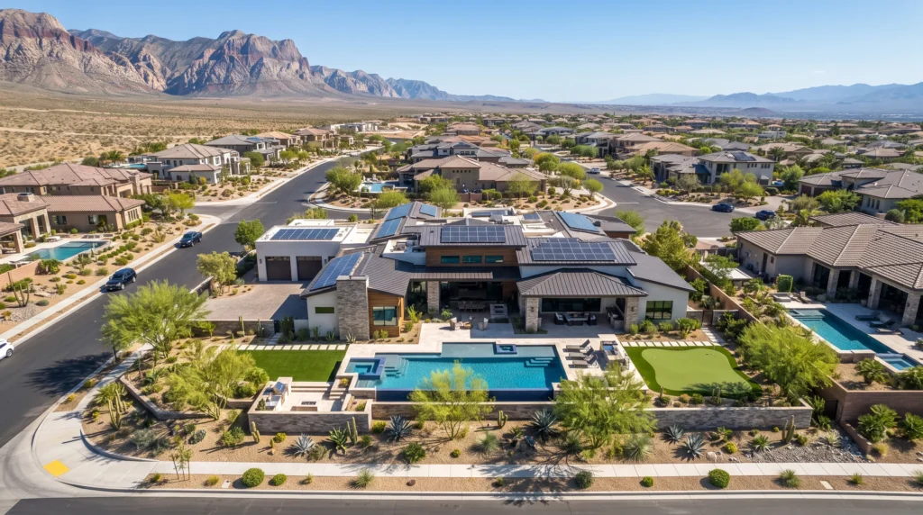
- The full property footprint. Large lots, acreage, and estate grounds simply do not fit in a ground-level frame. An overhead pass shows the whole parcel at once.
- Location and proximity. How close a property sits to the Strip, a freeway interchange, a park, or a commercial corridor is invisible from the front door but obvious from the air.
- Boundaries and layout. Aerials make lot lines, driveways, pools, outbuildings, and how the land is divided easy to read, which matters to buyers and investors planning use or renovation.
- Roof and exterior condition. An elevated view reveals the state of a roof, solar installation, or rooftop equipment that no one can assess from the curb.
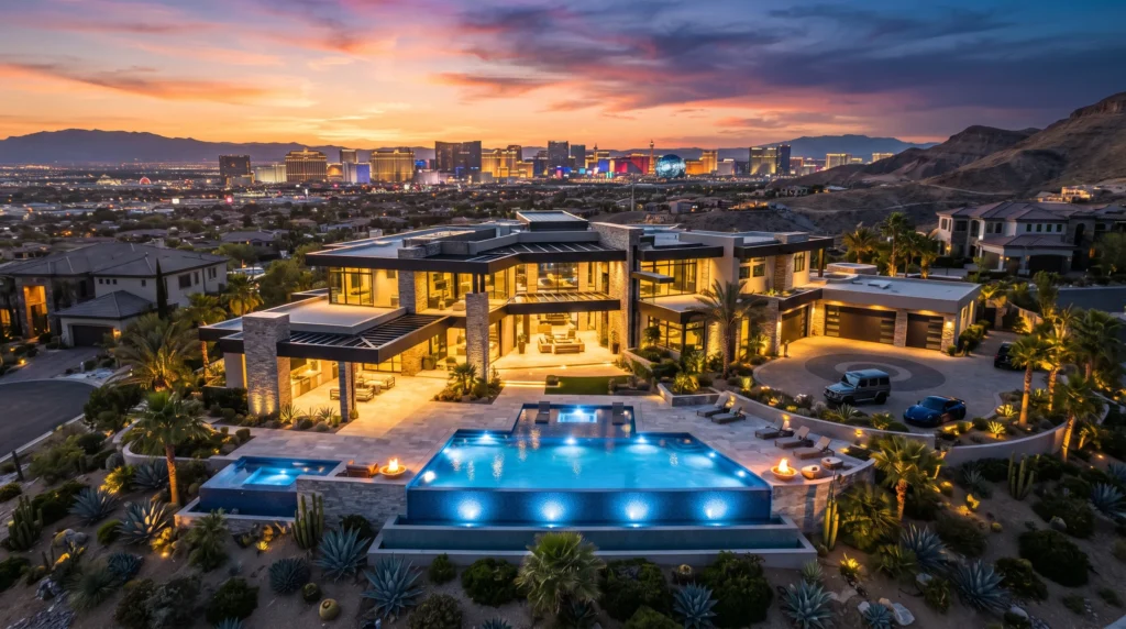
- The setting. Desert ridgelines, mountain backdrops, gated streets, and the surrounding skyline give a property a sense of place that grounds the rest of the listing.
For a buyer weighing a property from another city, that combination answers the practical "where exactly is this and what am I really getting" questions before they spend a dollar on travel.
Which listings need drone photography, and which do not?
Aerials earn their cost on some properties and add little to others. Knowing the difference keeps the budget sensible.
Drone photography pays off most for:
- Luxury homes and estates, where grounds, views, and setting are central to the value.
- Commercial and high-rise listings, where proximity to roads, retail, and landmarks is the pitch to a remote developer.
- Large lots and land, where the parcel cannot be shown any other way.
- Properties with a standout location, near a golf course, a lake, a mountain, or the Strip skyline.
- View properties, where the sightline from the home is a major selling point.
It adds less to a small interior condo with no land, no notable view, and a location best described in words. For those, strong real estate photography and a 3D tour usually do more than an aerial would. The honest rule: fly when the property's surroundings or scale sells it, skip it when they do not.
Do you need a license for real estate drone photography?
Yes, and this is where a lot of bargain operators quietly cut corners. In the United States, flying a drone for any commercial purpose, including photographing a property for a listing, requires the pilot to hold an FAA Part 107 Remote Pilot Certificate. A neighbor with a hobby drone and no certification is not legally permitted to shoot your listing for marketing, and hiring one exposes the work to real risk.
A certified pilot does more than hold a card. Part 107 covers airspace rules, weather judgment, and operating limits, and it signals that the person flying over a property and the people and cars near it know the regulations that keep the operation legal and safe. When a provider states plainly that they fly within current FAA rules, that is a trust signal worth weighting, because the alternative can mean fines, liability, and images you cannot safely use.
Flying a drone in Las Vegas: the airspace reality
Las Vegas is one of the trickier places in the country to fly a drone, and most out-of-town or amateur operators do not realize it until they are grounded. The valley sits under significant controlled airspace, driven by Harry Reid International Airport and Nellis Air Force Base, and large stretches of the city require authorization before a drone can legally go up.
In controlled airspace, a licensed pilot obtains clearance through the FAA's LAANC system, which grants authorization to fly up to set altitudes in specific areas. Knowing where those boundaries fall and where flight is restricted outright is local knowledge that takes experience to build. The airspace around the Strip and the airport is especially sensitive, and a pilot who does not understand the map either breaks the rules or wastes a shoot day discovering they cannot fly.
This is the single strongest reason to hire a licensed local operator rather than a generic "drone photography near me" search result who may not know the valley. An experienced Las Vegas pilot plans the flight around the airspace, secures the right authorizations, and frames the property legally so the shoot happens on schedule and the images are clean and usable.
Aerial photos vs aerial video
Both have a place, and the right call depends on how the listing will be used. Aerial photos are the workhorse: a set of stills showing the property, the lot, and the location from a few well-chosen angles, ideal for the MLS gallery and listing portals. Aerial video adds motion, a sweeping reveal that orbits the property or pulls back to expose the setting, which suits luxury listings, social media, and a marketing reel where pacing and drama matter.
For a typical listing, a focused set of aerial stills covers the need. For a high-end property where the marketing budget supports it, pairing stills with a short video clip gives the listing both the practical context and the cinematic hook.
Why "drone photography near me" matters more in Las Vegas
For most services, "near me" is about convenience. For drone work in this valley, it is about legality and results. A local, licensed pilot already understands the airspace map, the desert light, and the wind and heat conditions that affect a flight and can schedule around all of it. Someone driving in from elsewhere, or a hobbyist without certification, may arrive unable to fly in in the area at all, or able to fly but unfamiliar with how the harsh midday sun washes out glass and stucco.
Local experience also shapes composition. A pilot who has shot Summerlin towers, Spring Valley complexes, and Downtown high-rises knows which angle puts the skyline behind the building, which time of day flatters the exterior, and how to frame the property the way it actually sits in the valley. That fluency is the difference between an aerial that sells the location and one that merely floats above it.
How a drone shoot works
The on-site process is quick when the planning is done right. Before the flight, the pilot checks the airspace for the address, secures any required authorization, and reviews weather and wind. On the day, the drone captures the property from several elevations and angles, the pilot composes for the skyline, the lot, and the access routes, and the session typically wraps in well under an hour for a standard listing.
Preparation on the ground helps the result. Clearing the driveway of cars, opening gates, and tidying the yard all read from the air, since the camera records everything below it. For properties that are not photo-ready, an experienced operator can adjust on the day and clean up minor distractions in post. Editing follows, and the finished aerials are delivered, usually within a 24 to 48 hour window, often alongside the property's other media so the whole package lands together. Booking the drone work in the same visit as the Matterport 3D tour, floor plan, and virtual staging keeps everything consistent and saves a second appointment.
Booking real estate drone photography in Las Vegas
The cleanest approach is to hire a licensed local operator who can handle the aerials and the rest of the listing's media in one coordinated visit.
Virtual Tours Las Vegas has photographed properties across this market since 2010 under owner and sole photographer Mike Madsen, who personally handles each shoot from Summerlin towers to Spring Valley complexes and Downtown high-rises. He flies within current FAA rules, plans each flight around the valley's airspace, and knows how desert light hits glass, stucco, and steel at every hour, which shapes the timing and composition of every aerial set.
Projects typically arrive within a 24 to 48 hour turnaround, and as a Google Street View Trusted Photographer, Mike can also publish 360 content directly to the property's Google Maps listing for reach beyond the MLS. You can review the scope and examples on the drone photography services in Las Vegas page.
Frequently asked questions
What is real estate drone photography?
It is the use of an unmanned aircraft to photograph a property and its surroundings from the air. Aerials reveal the full lot, the location and proximity to landmarks, the roof and exterior, and the setting, context that ground-level photos cannot capture.
Do you need a license to fly a drone for real estate?
Yes. Any commercial drone work in the US, including photographing a listing, requires the pilot to hold an FAA Part 107 Remote Pilot Certificate. Hiring an uncertified hobbyist for marketing imagery is not legally permitted and carries real risk.
Can you fly a drone anywhere in Las Vegas?
No. Much of the valley sits in controlled airspace because of Harry Reid International Airport and Nellis Air Force Base, and those areas require FAA authorization, typically through the LAANC system, before a drone can fly. Some areas, especially near the airport and the Strip, are heavily restricted, which is why a licensed local pilot is essential.
Which properties benefit most from drone photography?
Luxury homes, estates, large lots and land, commercial and high-rise listings, and any property where location or views are the main selling point. Small interior condos with no land or notable view usually gain little from aerials.
What is the difference between aerial photos and aerial video?
Aerial photos are stills used in the MLS gallery and listing portals. Aerial video adds cinematic motion, a sweeping reveal of the property and setting, which suits luxury listings and marketing reels. Many listings use stills only; high-end ones often pair both.
How long does a drone shoot take to deliver?
After the flight, aerials are edited and delivered, usually within 24 to 48 hours, and often alongside the property's photos, 3D tour, and floor plan from the same visit.
Ready to show your listing from the air?
If your Las Vegas property's location, land, or views deserve to be seen, professional drone photography services in Las Vegas Nevada, USA put it in context for buyers deciding from anywhere. Call Mike Madsen at (702) 527-2732 for a free quote and get licensed, FAA-compliant aerials back fast, usually within a day or two.