
A ground-level photo can show a kitchen, a pool, or a front elevation. It cannot show how close a home sits to a golf course, how a lot backs up to open desert instead of another backyard, or how a high-rise unit relates to the Strip skyline. That's the gap aerial photography fills. This guide covers what drone shots actually add to a Las Vegas listing, which property types get the most value from them, how aerial images work alongside standard real estate photography, and what to do to get a shoot ready. It's written for agents and sellers who are trying to decide whether a listing needs aerial photos before booking anything.
What Aerial Photography Shows That Ground-Level Photos Can't
A standard photo shoot is built around rooms and curb appeal. A drone shoot is built around context - the information a buyer needs to understand where a property sits and what surrounds it.
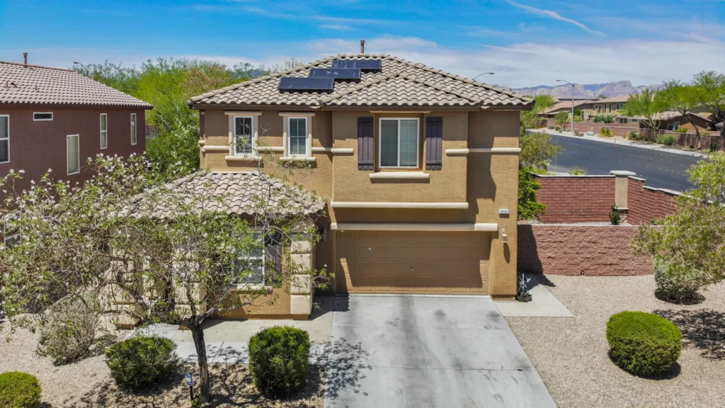
Lot size and shape. A wide-angle ground photo of a backyard compresses distance and makes lots look smaller than they are. An overhead shot shows the actual footprint, property lines, and how much usable yard space exists relative to the house.
Proximity to amenities and landmarks. Distance to a golf course, a community park, Red Rock Canyon, or the Strip is a selling point that's hard to communicate in text and impossible to show from the ground. An aerial frame settles the question in one image.
Neighborhood and street context. Cul-de-sac placement, corner-lot exposure, distance to the nearest busy road, and how a home sits relative to neighboring rooflines all show up clearly from altitude in a way no ground photo can replicate.
Roof condition and rear-yard features. Pools, sport courts, RV gates, casitas, and roof condition are often only fully visible from above, particularly on properties with block walls or mature landscaping blocking sightlines from the street.
Building elevation for towers and mid-rises. For high-rise and mid-rise condos, an aerial shot places the unit inside the building and the building inside the skyline - something a hallway or balcony photo can't do on its own.
None of this replaces interior photography. It answers a different question: not "what does this room look like," but "what does this property's location and layout actually offer."
Which Las Vegas Properties Benefit Most From Aerial Photography
Not every listing needs a drone shoot. The properties where aerial photos make the clearest difference share a few traits: larger lots, distinctive surroundings, or a location story that's hard to explain in a listing description.
Guard-Gated and Master-Planned Communities
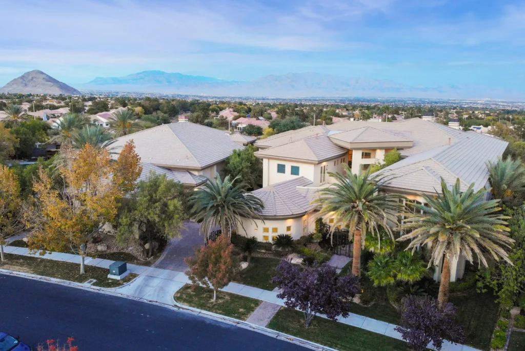
Neighborhoods like Summerlin, The Ridges, MacDonald Highlands, and Red Rock Country Club are often marketed on lifestyle as much as square footage - golf frontage, mountain views, gated entries, and community amenities. An aerial shot that shows a home's position relative to the fairway or the Spring Mountains does more to sell that lifestyle than an interior gallery can.
Homes With Pools, Large Lots, or Custom Landscaping
Backyard features are a major decision point for Las Vegas buyers, given how much of the year is spent outdoors. A pool, spa, outdoor kitchen, or desert-landscaped yard reads far better from above, where the full layout is visible in one frame instead of a series of cropped ground shots.
High-Rise and Mid-Rise Condo Towers
For towers near the Strip or Downtown, floor level and skyline exposure are part of the value. Aerial photography can show a building's setting - Strip proximity, freeway access, surrounding development - in a way that helps out-of-area or out-of-state buyers evaluate a unit without a site visit.
Commercial and Multi-Family Properties
For commercial listings, aerial photos are often functional rather than aesthetic: showing parking counts, loading access, lot boundaries, or a building's position within a retail or office corridor. This is information commercial buyers and investors look for before scheduling a walkthrough.
View Lots and Elevated Properties
Homes marketed on views - mountain, Strip, or golf - benefit from an aerial angle that captures what the view actually looks like from the property's elevation, rather than relying on a description alone.
For a standard tract home on a typical interior lot with no distinguishing view or feature, aerial photography adds less. In those cases, strong interior and exterior ground photography usually carries the listing on its own.
How Aerial Photos Work Alongside Standard Real Estate Photography
Drone photography isn't a replacement for interior photography, a Matterport scan, or twilight shots - it's a layer that adds context those formats don't cover.
A typical full marketing package for a listing that warrants it might combine:
- HDR interior and exterior photography for room detail, natural light, and curb appeal.
- Aerial photography for lot size, layout, and surrounding context.
- A Matterport 3D tour for a dimensionally accurate walkthrough buyers can explore remotely.
- A floor plan sourced from the same scan data, for buyers comparing layouts.
Used together, these formats answer different buyer questions: what does it look like inside, what does it feel like to walk through, how is it laid out, and where does it actually sit? A listing that only shows interiors leaves that last question unanswered, which matters more for the property types described above than for a typical interior-lot home.
What Buyers and Agents Actually Look For in Aerial Shots
Aerial photography works best when it's purposeful rather than decorative. A few things separate a useful aerial shot from a generic one:
- A clear line between the property and its surroundings. The shot should make it obvious where the lot starts and ends, not just show a rooftop from far away.
- An angle that supports the listing's main selling point. A golf-frontage home should be shot to show the fairway relationship; a view lot should be shot to show the view itself, not just the roofline.
- Consistent lighting with the rest of the gallery. Aerial shots taken at a different time of day or in different light than the ground photos can look mismatched in a listing gallery.
- A composition that reads well as a thumbnail. Many aerial shots get used as a secondary MLS photo or a social media graphic, where fine detail is lost - the composition needs to hold up at a smaller size.
How to Prepare a Property for a Drone Shoot
A few things on the seller or agent side make a meaningful difference in the final images:
- Clear the driveway and street frontage. Move vehicles, trash cans, and hoses out of view before the shoot window.
- Tidy the backyard. Pool covers, pet items, and stored equipment show up clearly from above and are harder to edit out than they are from ground level.
- Confirm landscaping is current. Freshly mowed grass and trimmed hedges read noticeably better in overhead shots than they do at eye level.
- Check HOA and community rules ahead of time. Some gated and master-planned communities in the Las Vegas Valley have their own drone policies in addition to FAA requirements - worth confirming before the shoot is scheduled, especially for guard-gated neighborhoods.
- Plan around timing, not just weather. Morning light is generally preferred for aerial shots in Southern Nevada, since midday desert sun creates harsh shadows and glare on rooftops and pavement that are more pronounced from above than at ground level.
Local Factors That Affect Drone Photography in the Las Vegas Valley
A few conditions specific to this market affect how and when aerial photography gets shot here:
Airspace restrictions near the Strip and Harry Reid International Airport. Large sections of the Las Vegas Valley fall under controlled airspace. A licensed operator flying under FAA Part 107 handles the authorization process for properties in these zones; this is one of the reasons hiring a certified, insured operator matters more in Las Vegas than in less restricted markets.
Desert light and heat. Midday sun in the valley creates high contrast and glare on light-colored roofing, stucco, and pavement. Early morning flights generally produce cleaner, more usable images.
Wind. Afternoon wind is common in the valley, particularly in spring, and can affect flight stability and image sharpness. Morning slots tend to be calmer.
Master-planned community layouts. Because so much of the valley is built around large-scale planned communities, aerial shots often do double duty - showing the property and giving buyers a sense of the surrounding community, trails, or golf layout in a single image.

How Aerial Photos Get Used Beyond the Primary Listing Photo
Once a shoot is complete, aerial images typically show up in more places than the MLS gallery:
- MLS and syndicated listing sites - as supporting photos alongside interior shots.
- Print and digital flyers - an aerial shot often works better than an interior shot as a flyer's lead image for view or golf-frontage properties.
- Social media marketing - aerial video clips and stills perform well as scroll-stopping content for "just listed" posts.
- Buyer presentations - for out-of-state or investor buyers, aerial context can stand in for a portion of an in-person site visit.
Conclusion
Aerial photography earns its place on a listing when a property has something a ground photo can't communicate - lot size, a view, proximity to a landmark, or a building's position in its surroundings. It's a supplement to strong interior photography and a 3D tour, not a substitute for either. Property types like golf and mountain-view homes, larger lots, high-rise condos, and commercial listings tend to see the clearest benefit, while a typical interior-lot home may not need it. If you're weighing whether a specific listing warrants aerial photography, Virtual Tours Las Vegas can walk through the property with you and recommend what actually fits - call (702) 527-2732d.
FAQs
Does every Las Vegas listing need drone photography?
No. It adds the most value for properties with a location-based selling point - a view, golf or mountain frontage, a large lot, or a high-rise setting. A standard interior-lot home without a distinguishing feature usually doesn't need it to market effectively.
Is drone photography legal near the Las Vegas Strip?
Parts of the Las Vegas Valley fall under controlled airspace near Harry Reid International Airport, which requires authorization to fly. A licensed operator working under FAA Part 107 handles that process as part of the shoot, which is one reason to confirm a photographer is certified before booking.
Can aerial photos be used as the main listing photo on the MLS?
Yes, aerial photos can be uploaded to the MLS alongside interior and exterior shots. Whether an aerial image works best as the lead photo depends on the property - it tends to work well for view or golf-frontage homes, less so for listings where the interior is the main draw.
How is drone photography different from a Matterport 3D tour?
A Matterport tour lets a buyer walk through the interior of a property remotely. Drone photography shows the property from above and its relationship to the surrounding area. They answer different questions and are often used together rather than in place of one another.
What time of day is best for a drone shoot in Las Vegas?
Morning is generally preferred. Midday desert sun creates strong glare and shadows on roofs and pavement, and afternoon wind in the valley can affect flight stability, so early flights tend to produce sharper, more usable images.